Map data © OpenStreetMap contributors. Distances and driving times are in our transport guide.
Marrakech and the High Atlas
| Place |
What it is |
Guide |
| Jemaa el-Fna · map |
The main square of the Marrakech medina, UNESCO-listed for its storytellers, musicians and evening food stalls. |
Read |
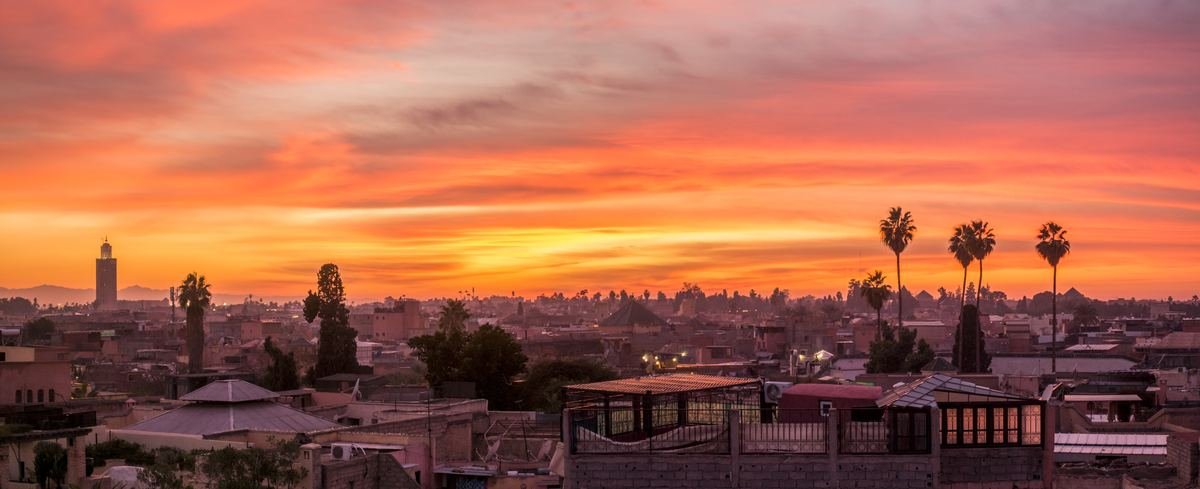
| Koutoubia Mosque · map |
12th-century Almohad mosque whose 77 m minaret is the landmark of Marrakech; non-Muslims admire it from the gardens. |
Read |
| Ben Youssef Madrasa · map |
Former Koranic school with a marble courtyard, zellige and carved cedar; reopened in 2022 after restoration. |
Read |
| Le Jardin Secret · map |
Restored riad gardens in the heart of the medina, with an exhibition on traditional water systems. |
Read |
| Bahia Palace · map |
Late-19th-century palace of painted ceilings, courtyards and gardens near the Mellah. |
Read |
| Saadian Tombs · map |
16th-century royal necropolis of the Saadian dynasty, rediscovered in 1917. |
Read |
| Jardin Majorelle and YSL Museum · map |
Cobalt-blue garden created by Jacques Majorelle and saved by Yves Saint Laurent; book a timed ticket online. |
Read |
| Menara Gardens · map |
Olive groves around a large basin and pavilion, with views of the Atlas on clear days. |
Read |
| Agafay Desert · map |
Stony desert about 40 minutes from Marrakech for camel rides, quad biking and dinner camps. |
Read |
| Ourika Valley (Setti Fatma) · map |
Green valley about 1.5 hours from Marrakech, with village walks and small waterfalls. |
Read |
| Imlil · map |
Mountain village at 1,740 m, the base for day walks and for the Toubkal climb. |
Read |
| Mount Toubkal · map |
North Africa's highest summit (4,167 m); a licensed guide is required for the climb. |
Read |
| Oukaïmeden · map |
High-altitude plateau and small ski area in the High Atlas, with prehistoric rock carvings. |
Read |
| Ouzoud Waterfalls · map |
Waterfalls about 110 m high, around 2.5–3 hours from Marrakech, with Barbary macaques on the paths. |
Read |
| Tizi n'Tichka pass · map |
High Atlas road pass (2,260 m) between Marrakech and Ouarzazate. |
Read |
| Telouet Kasbah · map |
Former Glaoui kasbah with richly decorated reception rooms, a short detour from the Tichka road. |
Read |
Fez, Meknes and the Middle Atlas
| Place |
What it is |
Guide |
| Bab Bou Jeloud · map |
The blue-tiled gate (1913) at the main entrance to Fes el-Bali. |
Read |
| Bou Inania Madrasa · map |
Marinid madrasa from the 1350s, famous for its carved cedar and stucco. |
Read |
| Al-Qarawiyyin Mosque · map |
Founded in 859 by Fatima al-Fihri; non-Muslims can glimpse the courtyard from the doorways. |
Read |
| Chouara Tannery · map |
Medieval tannery seen from the terraces of the surrounding leather shops. |
Read |
| Marinid Tombs · map |
Hilltop ruins above the medina, the classic sunset viewpoint over Fez. |
Read |
| Meknes (Bab Mansour) · map |
Imperial city of Moulay Ismail, best known for the monumental Bab Mansour gate. |
Read |
| Volubilis · map |
UNESCO-listed Roman city with mosaics still in place, about 1.5 hours from Fez. |
Read |
| Moulay Idriss Zerhoun · map |
Holy hill town next to Volubilis, built around the shrine of Idriss I. |
Read |
| Ifrane · map |
Alpine-style town of the Middle Atlas, cool in summer and sometimes snowy in winter. |
Read |
| Azrou cedar forest · map |
Atlas cedar forest where Barbary macaques live; please do not feed them. |
Read |
| Midelt · map |
Apple-growing town below the Jbel Ayachi, a useful overnight stop between Fez and the desert. |
Read |
The north
| Place |
What it is |
Guide |
| Kasbah Museum, Tangier · map |
Museum in the former sultan's palace at the top of the Tangier kasbah. |
Read |
| Tangier American Legation · map |
The first US public property abroad (1821), now a museum and cultural centre. |
Read |
| Café Hafa · map |
Terraced café opened in 1921, with mint tea and views across the Strait of Gibraltar. |
Read |
| Caves of Hercules · map |
Sea caves west of Tangier with an opening shaped like a map of Africa. |
Read |
| Cap Spartel · map |
Lighthouse headland where the Atlantic meets the Mediterranean. |
Read |
| Asilah · map |
Whitewashed Atlantic town with ramparts and murals, an easy day trip from Tangier. |
Read |
| Tetouan medina · map |
UNESCO-listed medina with strong Andalusian influence. |
Read |
| Chefchaouen medina · map |
The blue town of the Rif Mountains, founded in 1471, centred on Outa el-Hammam square. |
Read |
| Spanish Mosque, Chefchaouen · map |
Hilltop mosque reached in about 20 minutes on foot; the sunset viewpoint over the blue town. |
Read |
| Akchour waterfalls and God's Bridge · map |
River walks in Talassemtane National Park, about 45 minutes from Chefchaouen. |
Read |
| Al Hoceima · map |
Mediterranean resort town with coves and a national park. |
Read |
Rabat, Casablanca and the Atlantic coast
| Place |
What it is |
Guide |
| Kasbah of the Udayas · map |
Blue-and-white fortress quarter above the Bou Regreg river, with Andalusian gardens. |
Read |
| Hassan Tower and Mausoleum of Mohammed V · map |
Unfinished 12th-century minaret (44 m) facing the royal mausoleum. |
Read |
| Chellah · map |
Roman and Marinid ruins in a walled garden, home to nesting storks. |
Read |
| Hassan II Mosque · map |
Completed in 1993 on the Atlantic, with a minaret of about 210 m; guided tours for visitors. |
Read |
| El Jadida (Portuguese City) · map |
UNESCO-listed Portuguese fortified city, known for its underground cistern. |
Read |
| Safi · map |
Atlantic port town and Morocco's pottery capital. |
Read |
| Skala de la Ville, Essaouira · map |
18th-century sea ramparts with bronze cannons, the sunset spot of Essaouira. |
Read |
| Essaouira port · map |
Working fishing harbour with blue boats and grilled-fish stalls. |
Read |
| Agadir · map |
Beach resort with a long bay and year-round sun. |
Read |
| Taghazout · map |
Surf village about 20 km north of Agadir, with breaks for all levels. |
Read |
| Imsouane · map |
Fishing village known for one of Africa's longest right-hand waves. |
Read |
| Taroudant · map |
Walled market town in the Souss valley, sometimes called a little Marrakech. |
Read |
| Dakhla · map |
Lagoon town in the far south, a kitesurfing hub about 1,400 km from Marrakech by road; most visitors fly. |
Read |
The south and the Sahara
| Place |
What it is |
Guide |
| Aït Benhaddou · map |
UNESCO-listed earthen ksar (1987), a film location used as Troy in Nolan's The Odyssey. |
Read |
| Taourirt Kasbah · map |
Glaoui kasbah in the centre of Ouarzazate. |
Read |
| Atlas Film Studios · map |
Film studios on the edge of Ouarzazate with guided tours of the sets. |
Read |
| Skoura palm grove · map |
Oasis of palms and kasbahs on the Road of a Thousand Kasbahs. |
Read |
| Kalaat M'Gouna · map |
Valley of roses, with a rose festival each May. |
Read |
| Dades valley (Boumalne Dades) · map |
Valley and gorges with guesthouses facing the canyon, a common overnight stop. |
Read |
| Todra Gorges · map |
Canyon near Tinghir where the walls rise about 300 m above the river. |
Read |
| Erfoud · map |
Oasis town known for fossils and its date festival. |
Read |
| Rissani · map |
Market town of the Tafilalet with ksour and a lively souk. |
Read |
| Merzouga · map |
Village at the foot of the Erg Chebbi dunes, the base for desert camps. |
Read |
| Erg Chebbi dunes · map |
Sand sea about 22 km long, with dunes up to about 150 m. |
Read |
| Khamlia · map |
Village of Gnawa musicians south of Merzouga. |
Read |
| Zagora · map |
Town of the Draa valley palm groves and a gateway to smaller desert dunes. |
Read |
The east
| Place |
What it is |
Guide |
| Oujda · map |
Eastern city near the Algerian border, with a historic medina. |
Read |
Frequently asked questions
What are the must-see places in Morocco for a first trip?
Most first trips combine Marrakech, the High Atlas, Aït Benhaddou, the Merzouga dunes and Fez, with Chefchaouen or Essaouira if time allows. Our 7-day and 10-day itineraries link them in a realistic order.
How far apart are the main sights?
Marrakech to Merzouga is about 560 km (9–10 hours by road), Fez to Merzouga about 470 km (7–8 hours) and Marrakech to Essaouira about 3 hours. See the transport guide.
This guide was last reviewed in November 2026. Entry rules, opening hours, transport timetables and prices change; check official sources shortly before you travel. Spotted something out of date? Tell us.